Lesson 04
Retrieving data from OpenStreetMap
goals of the tutorial
- understand openstreetmap
- understand the openstreetmap data model
- manage openstreetmap data in geopandas
requirements
- python knowledge
- geopandas
- gis concepts
status
“OpenStreetMap is a commons” —
Setup
try:
  import pygeos
except ModuleNotFoundError as e:
  !pip install pygeos==0.10.2
  import pygeos
try:
  import geopandas as gpd
except ModuleNotFoundError as e:
  !pip install geopandas==0.10.2
  import geopandas as gpd
if gpd.__version__ != "0.10.2":
  !pip install -U geopandas==0.10.2
  import geopandas as gpd
try:
  import pyrosm
except ModuleNotFoundError as e:
  !pip install pyrosm==0.6.1
  import pyrosm

#if pyrosm.__version__ != "0.6.1":
#   !pip install -U pyrosm==0.6.1
#   import pyrosm
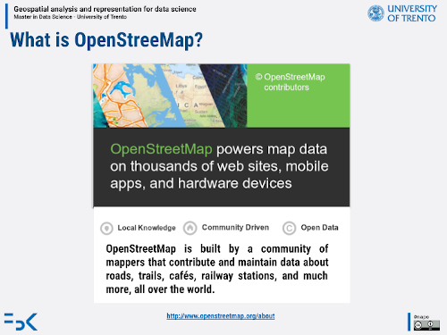
OpenStreetMap
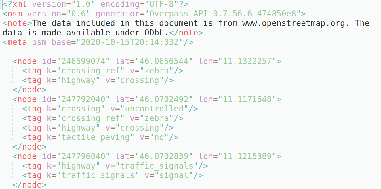
RAW Data
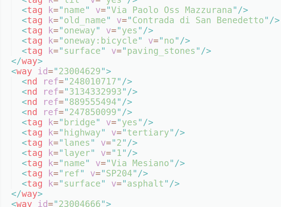
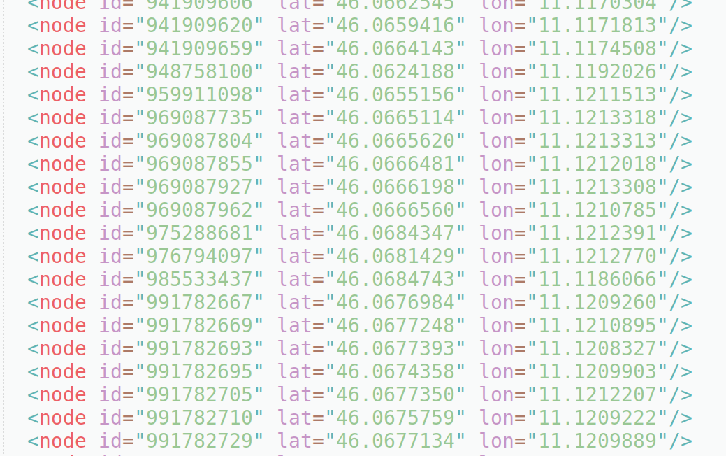
OSM XML
…
…
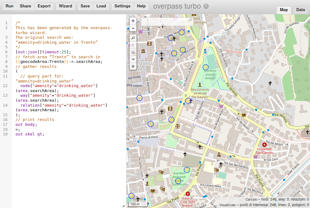
OverPass API
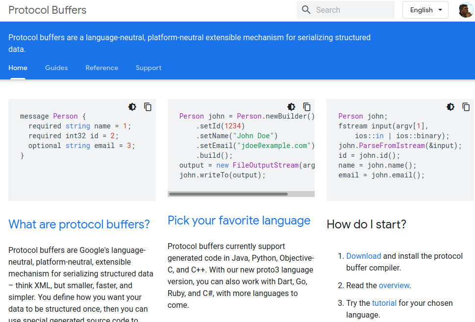
Protocol Buffer
https://developers.google.com/protocol-buffers
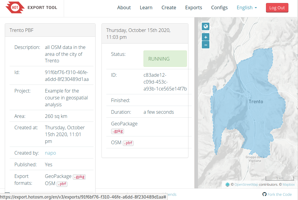
Export from HOTOSM
PYROSM
OpenStreetMap PBF data parser for Python
note: install it always after geopandas
import pyrosm
from pyrosm.data import sources
import matplotlib.pyplot as plt
import warnings
from shapely.errors import ShapelyDeprecationWarning
warnings.filterwarnings("ignore", category=ShapelyDeprecationWarning)
Print available source categories
sources.available.keys()
dict_keys(['africa', 'antarctica', 'asia', 'australia_oceania', 'central_america', 'europe', 'north_america', 'south_america', 'cities', 'subregions'])
Prints a list of countries in Europa that can be downloaded
sources.europe.available
['albania',
 'andorra',
 'austria',
 'azores',
 'belarus',
 'belgium',
 'bosnia_herzegovina',
 'bulgaria',
 'croatia',
 'cyprus',
 'czech_republic',
 'denmark',
 'estonia',
 'faroe_islands',
 'finland',
 'france',
 'georgia',
 'germany',
 'great_britain',
 'greece',
 'hungary',
 'iceland',
 'ireland_and_northern_ireland',
 'isle_of_man',
 'italy',
 'kosovo',
 'latvia',
 'liechtenstein',
 'lithuania',
 'luxembourg',
 'macedonia',
 'malta',
 'moldova',
 'monaco',
 'montenegro',
 'netherlands',
 'norway',
 'poland',
 'portugal',
 'romania',
 'russia',
 'serbia',
 'slovakia',
 'slovenia',
 'spain',
 'sweden',
 'switzerland',
 'turkey',
 'ukraine']
Print a list of all cities that can be downloaded
sources.cities.available
['Aachen',
 'Aarhus',
 'Adelaide',
 'Albuquerque',
 'Alexandria',
 'Amsterdam',
 'Antwerpen',
 'Arnhem',
 'Auckland',
 'Augsburg',
 'Austin',
 'Baghdad',
 'Baku',
 'Balaton',
 'Bamberg',
 'Bangkok',
 'Barcelona',
 'Basel',
 'Beijing',
 'Beirut',
 'Berkeley',
 'Berlin',
 'Bern',
 'Bielefeld',
 'Birmingham',
 'Bochum',
 'Bogota',
 'Bombay',
 'Bonn',
 'Bordeaux',
 'Boulder',
 'BrandenburgHavel',
 'Braunschweig',
 'Bremen',
 'Bremerhaven',
 'Brisbane',
 'Bristol',
 'Brno',
 'Bruegge',
 'Bruessel',
 'Budapest',
 'BuenosAires',
 'Cairo',
 'Calgary',
 'Cambridge',
 'CambridgeMa',
 'Canberra',
 'CapeTown',
 'Chemnitz',
 'Chicago',
 'ClermontFerrand',
 'Colmar',
 'Copenhagen',
 'Cork',
 'Corsica',
 'Corvallis',
 'Cottbus',
 'Cracow',
 'CraterLake',
 'Curitiba',
 'Cusco',
 'Dallas',
 'Darmstadt',
 'Davis',
 'DenHaag',
 'Denver',
 'Dessau',
 'Dortmund',
 'Dresden',
 'Dublin',
 'Duesseldorf',
 'Duisburg',
 'Edinburgh',
 'Eindhoven',
 'Emden',
 'Erfurt',
 'Erlangen',
 'Eugene',
 'Flensburg',
 'FortCollins',
 'Frankfurt',
 'FrankfurtOder',
 'Freiburg',
 'Gdansk',
 'Genf',
 'Gent',
 'Gera',
 'Glasgow',
 'Gliwice',
 'Goerlitz',
 'Goeteborg',
 'Goettingen',
 'Graz',
 'Groningen',
 'Halifax',
 'Halle',
 'Hamburg',
 'Hamm',
 'Hannover',
 'Heilbronn',
 'Helsinki',
 'Hertogenbosch',
 'Huntsville',
 'Innsbruck',
 'Istanbul',
 'Jena',
 'Jerusalem',
 'Johannesburg',
 'Kaiserslautern',
 'Karlsruhe',
 'Kassel',
 'Katowice',
 'Kaunas',
 'Kiel',
 'Kiew',
 'Koblenz',
 'Koeln',
 'Konstanz',
 'LaPaz',
 'LaPlata',
 'LakeGarda',
 'Lausanne',
 'Leeds',
 'Leipzig',
 'Lima',
 'Linz',
 'Lisbon',
 'Liverpool',
 'Ljubljana',
 'Lodz',
 'London',
 'Luebeck',
 'Luxemburg',
 'Lyon',
 'Maastricht',
 'Madison',
 'Madrid',
 'Magdeburg',
 'Mainz',
 'Malmoe',
 'Manchester',
 'Mannheim',
 'Marseille',
 'Melbourne',
 'Memphis',
 'MexicoCity',
 'Miami',
 'Moenchengladbach',
 'Montevideo',
 'Montpellier',
 'Montreal',
 'Moscow',
 'Muenchen',
 'Muenster',
 'NewDelhi',
 'NewOrleans',
 'NewYorkCity',
 'Nuernberg',
 'Oldenburg',
 'Oranienburg',
 'Orlando',
 'Oslo',
 'Osnabrueck',
 'Ostrava',
 'Ottawa',
 'Paderborn',
 'Palma',
 'PaloAlto',
 'Paris',
 'Perth',
 'Philadelphia',
 'PhnomPenh',
 'Portland',
 'PortlandME',
 'Porto',
 'PortoAlegre',
 'Potsdam',
 'Poznan',
 'Prag',
 'Providence',
 'Regensburg',
 'Riga',
 'RiodeJaneiro',
 'Rostock',
 'Rotterdam',
 'Ruegen',
 'Saarbruecken',
 'Sacramento',
 'Saigon',
 'Salzburg',
 'SanFrancisco',
 'SanJose',
 'SanktPetersburg',
 'SantaBarbara',
 'SantaCruz',
 'Santiago',
 'Sarajewo',
 'Schwerin',
 'Seattle',
 'Seoul',
 'Sheffield',
 'Singapore',
 'Sofia',
 'Stockholm',
 'Stockton',
 'Strassburg',
 'Stuttgart',
 'Sucre',
 'Sydney',
 'Szczecin',
 'Tallinn',
 'Tehran',
 'Tilburg',
 'Tokyo',
 'Toronto',
 'Toulouse',
 'Trondheim',
 'Tucson',
 'Turin',
 'UlanBator',
 'Ulm',
 'Usedom',
 'Utrecht',
 'Vancouver',
 'Victoria',
 'WarenMueritz',
 'Warsaw',
 'WashingtonDC',
 'Waterloo',
 'Wien',
 'Wroclaw',
 'Wuerzburg',
 'Wuppertal',
 'Zagreb',
 'Zuerich']
Check all countries having sub-regions
sources.subregions.available.keys()
dict_keys(['brazil', 'canada', 'france', 'germany', 'great_britain', 'italy', 'japan', 'netherlands', 'poland', 'russia', 'usa'])
Check sub-regions in Italy
sources.subregions.italy.available
['centro', 'isole', 'nord_est', 'nord_ovest', 'sud']
there aren’t other subregions or cities …
for the italian regions, provinces and cities you can use the service made by Wikimedia Italia
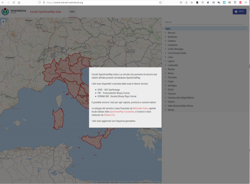
https://osmit-estratti.wmcloud.org/
Eg. Trento
import os
trento_download_pbf_url = "https://osmit-estratti.wmcloud.org/dati/poly/comuni/pbf/022205_Trento_poly.osm.pbf"
# download the data
import requests
#request the file
r = requests.get(trento_download_pbf_url, allow_redirects=True)
#save the file
open('trento.pbf', 'wb').write(r.content)
3813935
osm = pyrosm.OSM("trento.pbf")
osm.conf.tags.available
['aerialway',
 'aeroway',
 'amenity',
 'boundary',
 'building',
 'craft',
 'emergency',
 'geological',
 'highway',
 'historic',
 'landuse',
 'leisure',
 'natural',
 'office',
 'power',
 'public_transport',
 'railway',
 'route',
 'place',
 'shop',
 'tourism',
 'waterway']
osm.conf.tags.amenity
['addr:city',
 'addr:country',
 'addr:full',
 'addr:housenumber',
 'addr:housename',
 'addr:postcode',
 'addr:place',
 'addr:street',
 'email',
 'name',
 'opening_hours',
 'operator',
 'phone',
 'ref',
 'url',
 'website',
 'yes',
 'amenity',
 'arts_centre',
 'atm',
 'bank',
 'bicycle_parking',
 'bicycle_rental',
 'bicycle_repair_station',
 'bar',
 'bbq',
 'biergarten',
 'brothel',
 'building',
 'building:levels',
 'bureau_de_change',
 'bus_station',
 'bus_stop',
 'cafe',
 'car_rental',
 'car_repair',
 'car_sharing',
 'car_wash',
 'casino',
 'charging_station',
 'childcare',
 'cinema',
 'clinic',
 'college',
 'dentist',
 'doctors',
 'driving_school',
 'drinking_water',
 'fast_food',
 'ferry_terminal',
 'fire_station',
 'food_court',
 'fountain',
 'fuel',
 'gambling',
 'hospital',
 'ice_cream',
 'internet_access',
 'kindergarten',
 'landuse',
 'language_school',
 'library',
 'music_school',
 'nightclub',
 'nursing_home',
 'office',
 'operator',
 'parking',
 'pharmasy',
 'planetarium',
 'police',
 'post_office',
 'pub',
 'public_bath',
 'rescue_station',
 'restaurant',
 'retirement_home',
 'school',
 'social_centre',
 'social_facility',
 'source',
 'spa',
 'start_date',
 'stripclub',
 'taxi',
 'theatre',
 'university',
 'wikipedia']
%%time
buildings = osm.get_buildings()
buildings.plot(figsize=(12,12))
plt.show()
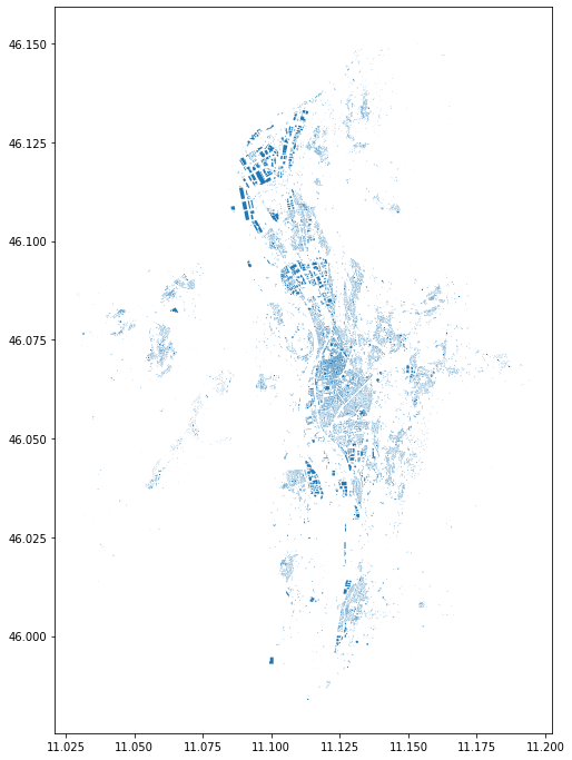
CPU times: user 6.75 s, sys: 164 ms, total: 6.91 s
Wall time: 6.91 s
buildings.head(4)
| addr:city | addr:country | addr:housenumber | addr:housename | addr:postcode | addr:street | name | opening_hours | operator | ... | start_date | wikipedia | id | timestamp | version | geometry | tags | osm_type | levels | changeset | ||
|---|---|---|---|---|---|---|---|---|---|---|---|---|---|---|---|---|---|---|---|---|---|
| 0 | None | None | 18 | None | 38122 | Piazza del Duomo | None | Palazzo Pretorio | None | None | ... | None | it:Palazzo_Pretorio_(Trento) | 24785843 | 1594291784 | 8 | POLYGON ((11.12216 46.06701, 11.12205 46.06701... | {"access":"customers","castle_type":"palace","... | way | NaN | NaN |
| 1 | None | None | None | None | None | None | None | P3 - Garage Autosilo Buonconsiglio | Mo-Su 00:00-24:00 | Trentino Mobilità S.p.A. | ... | None | None | 24860487 | 1627543078 | 22 | POLYGON ((11.12425 46.07428, 11.12424 46.07429... | {"access":"yes","capacity":"480","capacity:dis... | way | NaN | NaN |
| 2 | None | None | None | None | None | None | None | Laboratori Ingegneria | None | None | ... | None | None | 24862284 | 1593194970 | 4 | POLYGON ((11.13954 46.06698, 11.13948 46.06644... | None | way | NaN | NaN |
| 3 | None | None | None | None | None | None | None | Mensa e bar Mesiano | Mo-Fr 11:45-14:30 | None | ... | None | None | 24862387 | 1635544382 | 3 | POLYGON ((11.13982 46.06637, 11.13981 46.06612... | None | way | NaN | NaN |
4 rows × 36 columns
%%time
drive_net = osm.get_network(network_type="driving")
drive_net.plot(figsize=(10,10))
plt.show()
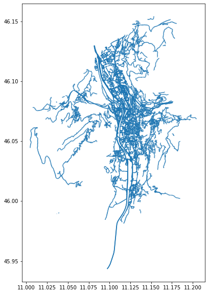
CPU times: user 3.46 s, sys: 24.1 ms, total: 3.48 s
Wall time: 3.48 s
%%time
walk = osm.get_network("walking")
walk.plot(color="k", figsize=(12,12), lw=0.7, alpha=0.6)
plt.show()
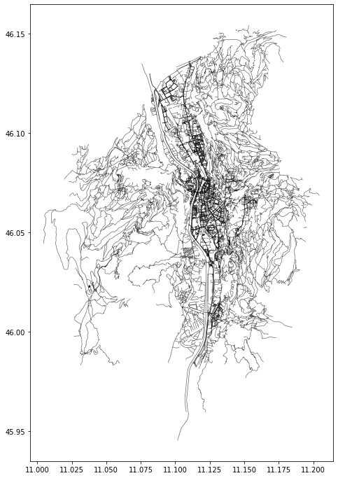
CPU times: user 7.09 s, sys: 47.8 ms, total: 7.13 s
Wall time: 7.13 s
%%time
custom_filter = {'amenity': True, "shop": True}
pois = osm.get_pois(custom_filter=custom_filter)

# Gather info about POI type (combines the tag info from "amenity" and "shop")
pois["poi_type"] = pois["amenity"]
pois["poi_type"] = pois["poi_type"].fillna(pois["shop"])

# Plot
ax = pois.plot(column='poi_type', markersize=3, figsize=(12,12), legend=True, legend_kwds=dict(loc='upper left', ncol=5, bbox_to_anchor=(1, 1)))
plt.show()
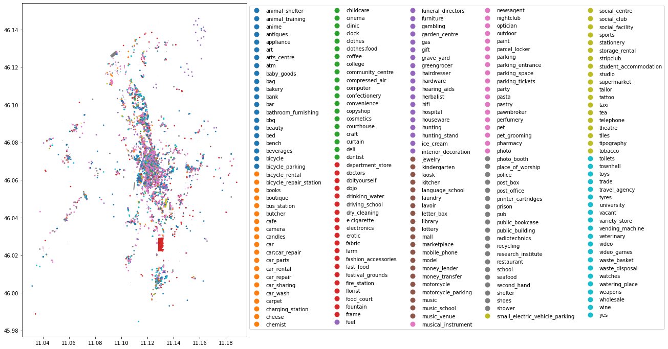
CPU times: user 4.98 s, sys: 168 ms, total: 5.15 s
Wall time: 5.14 s
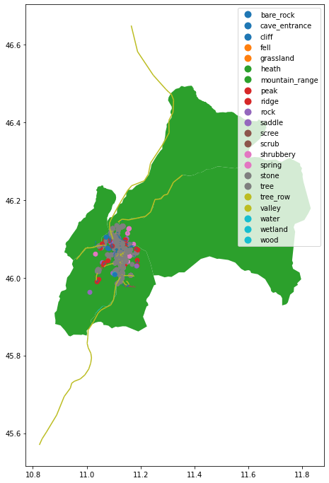
natural = osm.get_natural()
natural.plot(column='natural', legend=True, figsize=(12,12))
plt.show()
Exercises
-
download from OpenStreetMap all supermarkets inside the bounding box of the city in this point
latitude: 45.4395
longitude: 12.3478 -
identify the longest road of the city (state roads, walking routes, motorways are excluded).
-
How many drinking water are in this city?
-
how many benches in this city have the backrest?